- Researching our History
- Previous use as Tennis Courts
- Hospital Staff Accessing the Site
- Aerial Photographs
- The Cottage Hospital
- Then and Now
Researching our History
We are currently researching the history of the Meadow Orchard Community Garden site and would be interested if anyone has knowledge or better, photos of the site from when it was previously used as tennis courts, prior to becoming derelict and later established as a community garden.
Meadow Orchard Project is a community Garden in Crouch End, a 1.5 acre site located behind Hornsey Medical Centre, 151, Park Road, N8 8JD. The site is located on Metropolitan Open Land, designated for recreational use, also consisting of the area of playing fields, Crouch End Cricket Fields.

Previous use as Tennis Courts
From our limited research, speaking to local residents and using the Scottish Map Archive. The site was home to two Tennis Clubs, Harefield Club to the west and Circle 23 to the West. Each had a small pavilion, there are some earth works, drain gulleys, all that now remains of those structures.
Hospital Staff Accessing the Site
A search in the Wellcome Collection Archive resulted in the discovery of these minutes from December 31st 1929
“Sincere thanks are also due to the Harefield, Independent, and Barrington Lawn Tennis Clubs for permitting the nursing staff to use their courts.”
Early evidence of “green prescribing” on the what is now the Meadow Orchard Site!
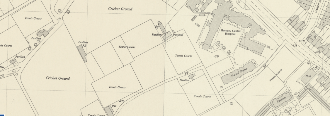
In the late 1980’s or early 1990’s the demand for Tennis was in decline and the number of courts was reduced. The land was sold to the NHS, around the same time a number of Tennis Courts along the boundary to the North were removed and the cricket grounds extended into this area.
Aerial Photographs
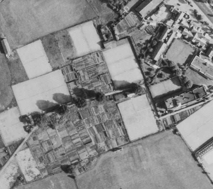
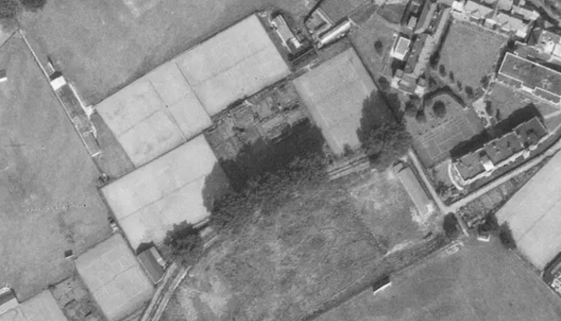
Aerial Photos dated 1944-1950 clearly show the tennis courts at each end of the site and a patchwork of allotment plots on what is now the Meadow. Digging on site in the areas used as tennis courts reveals very little topsoil and a layer of clinker (The non-combustible remains from burning coal) used as a drainage medium until around the 1950’s or so.
Edit 06/02/2025 We have kindly received these high resolution images from Hugh from the Harringay Online Forum. The first photograph dated 24 July 1947, clearly showing the tennis courts, pavilions and haphazard mosaic of allotment plots on the Meadow Orchard Site and to the south more allotments and presumably Oakfield Tennis club, in what is now the school playground. The images are available at Historic England using their online photo archive search facility.

In the third image taken 13 September 1960 by RAF 543 squadron (a photographic reconnaissance squadron of the Royal Air Force) Sortie 543/1059, the tennis courts and allotments to the south have gone, presumably around the time that the land was sold and Bishopswood school built.

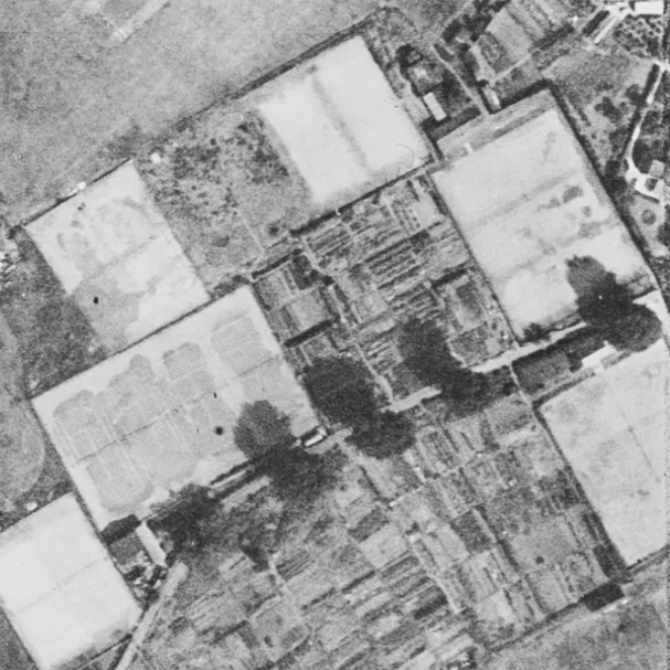
Scrolling the map reveals other local areas of allotment plots, Alexandra Park and the meadow area to the North of Shepherds hill allotments, presumably a part of the Dig for Victory Campaign.
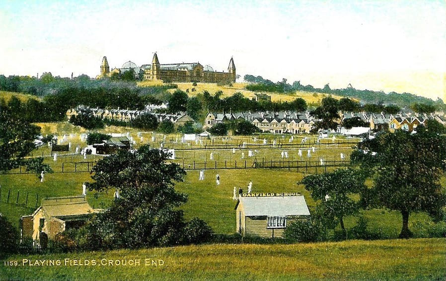
The Cottage Hospital
The below photo from the Hornsey Histological Society shows the cottage hospital, to the right of the photo is the distinctive octagonal war memorial building which has been preserved and remains a war memorial.
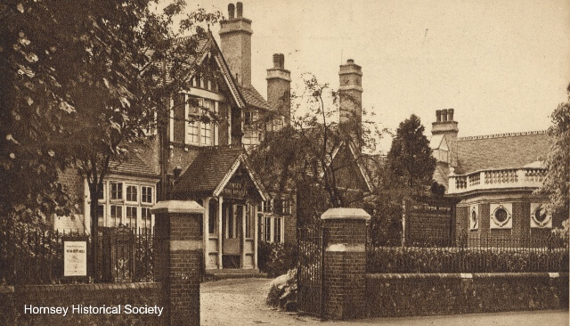
In 2009 The victorian cottage hospital building was demolished to pave way for the current Medical Centre, the area of land behind the site was at that point derelict and in 2010 was made available for community use, to be managed as a Community Garden, which is when the community garden was founded, previously the Shepherds Cot Healing Garden and currently The Meadow Orchard Project.
Historical Maps show the use as open agricultural land, prior to tennis courts, the courts shown on maps and aerial photographs, but very little evidence of it’s use in between the Aerial Photos above and the early low resolution Aerial Photos with the introduction of Google Satellite View.
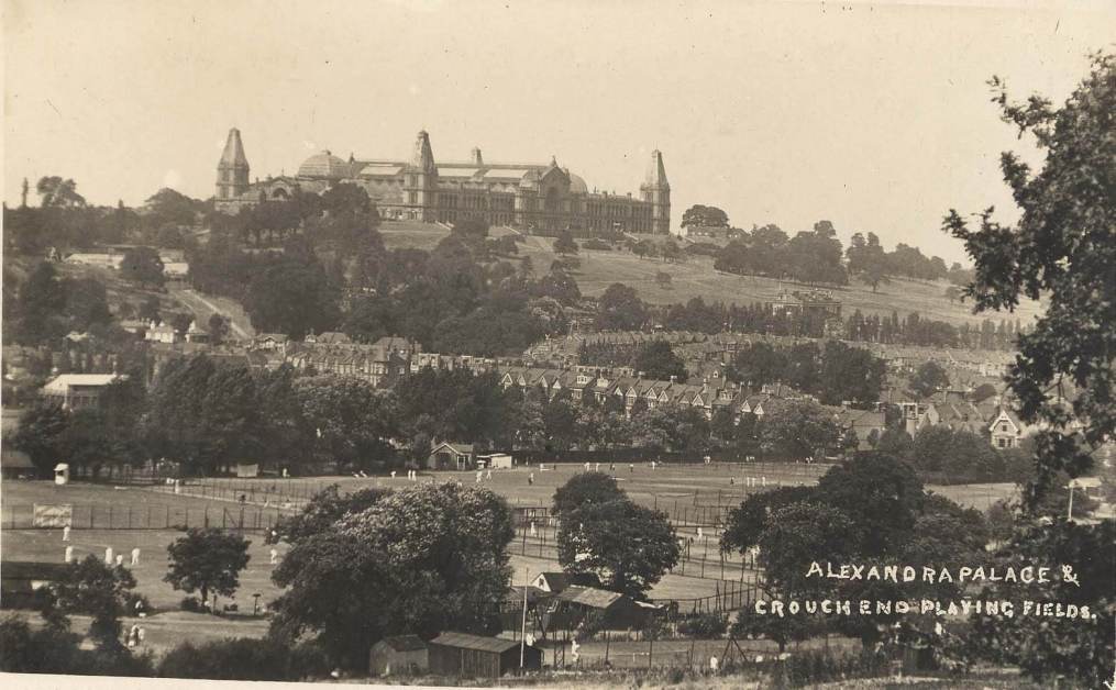
There are some local photos from the Victorian and Edwardian Period taken from Shepherds Hill of Alexandra palace and recognisable buildings in Park Road, from which it would be possible to triangulate and give an indication of what was on the meadow orchard site ack then.
There are clearly locals with first hand experience of the site, who will have played tennis on the site, walked past the site using the public footpath or attended Bishopswood School (now Highgate Wood School) to the south.
If you have knowledge of the site or can provide any clearer details, dates or photos of the site, please get in touch and send us an email.
Then and Now
The YouTube video shows the most recent google satellite view of the site overlayed with the 1947 aerial photograph to show the extent of the areas surfaced by the tennis courts.

You must be logged in to post a comment.